Destinations
Anuradhapura
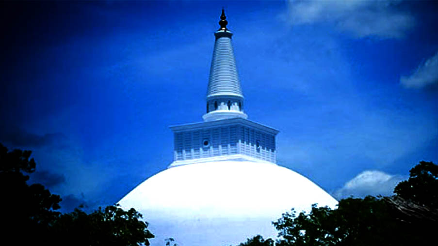
Anuradhapura is a major city in Sri Lanka. It is the capital city of North Central Province, Sri Lanka and the capital of Anuradhapura District. Anuradhapura is one of the ancient capitals of Sri Lanka, famous for its well-preserved ruins of ancient Sri Lankan civilization. It was
The city, now a UNESCO World Heritage Site, was the
Bentota
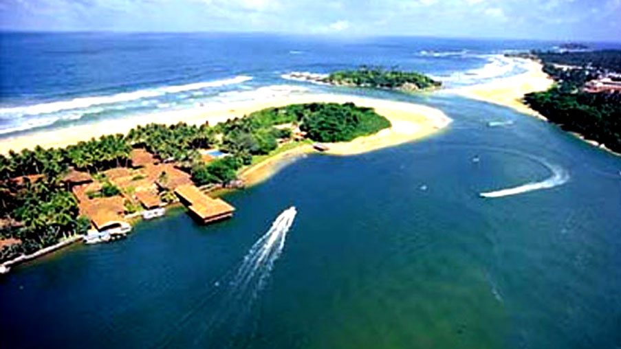
Bentota is a town in Sri
Bentota is the prime beach resort of the south-western and southern coastal belts of Sri Lanka. Bentota is a tourist attraction, with a handful of world-class hotels. It is a destination for watersports.Bentota also delivers an ancient art of healing called Ayurveda. Bentota is famous for its toddy production, an alcoholic beverage made out of coconut nectar.
Colombo
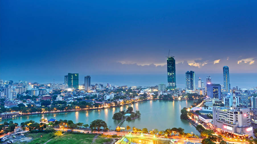
Colombo is the largest city and the commercial capital of Sri Lanka. It is located on the west coast of the island and adjacent to Sri Jayawardenepura Kotte (which is the official capital of Sri Lanka) suburb or the parliament capital of Sri Lanka. Colombo is also the administrative capital of Western Province, Sri Lanka and the district capital of Colombo District. Colombo is often referred to as the capital since Sri Jayawardenepura Kotte is a satellite city of Colombo. Colombo is a busy and vibrant place with a mixture of modern life and colonial buildings and ruins. It was the political capital of Sri Lanka, before Sri Jayawardenepura Kotte.
Due to its large harbour and its strategic position along the East-West sea trade routes, Colombo
The main city is home to a majority of Sri Lanka’s corporate offices, restaurants and entertainment venues. Famous landmarks in Colombo include the Galle Face Green, the Viharamahadevi Park, Mount Lavinia beach as well as the National Museum.
Dambulla
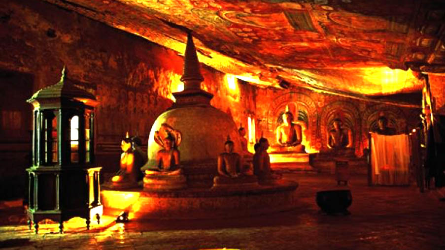
Dambulla is a big town, situated in the Matale District, Central Province of Sri Lanka, situated 148 km north-east of Colombo and 72 km north of Kandy. Due to its location at a major junction, it’s the centre of vegetable distribution in the country.
Major attractions of the area include the largest and
Ibbankatuwa prehistoric burial site near Dambulla cave temple complexes is the latest archaeological site of significant historical importance found in Dambulla, which is located within 3
Galle
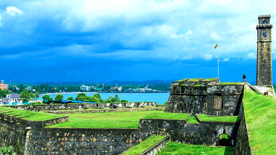
Galle is a major city in Sri Lanka, situated on the southwestern tip of Sri Lanka, 119 km from Colombo. Galle is the administrative capital of Southern Province, Sri Lanka and is the district capital of Galle District. Galle is the fourth largest city in Sri Lanka after the capital Colombo, Kandy and Jaffna.
Galle was known as Gimhathiththa before the arrival of the Portuguese in the 16th
Important natural geographical features in Galle include Rumassala in Unawatuna, a large mound-like hill, which forms the eastern protective barrier to the Galle harbour. Local tradition associates this hill with some events of Ramayana, one of the great Hindu epics.
Hikkaduwa
Hikkaduwa has long been among the most popular of Sri Lanka’s beach spots. Its proximity to the capital (98km from the Fort) helps – many people come here direct from the airport to start their classic Asian beach holiday. And it’s got a definite fun vibe, especially at its southern end, where there are dozens of affordable guesthouses built along a beautiful stretch of wide beach. At night, backpackers wander the sand from one café to the next, enjoying the sunset and the pleasures beyond.
Hikkaduwa Coral Gardens
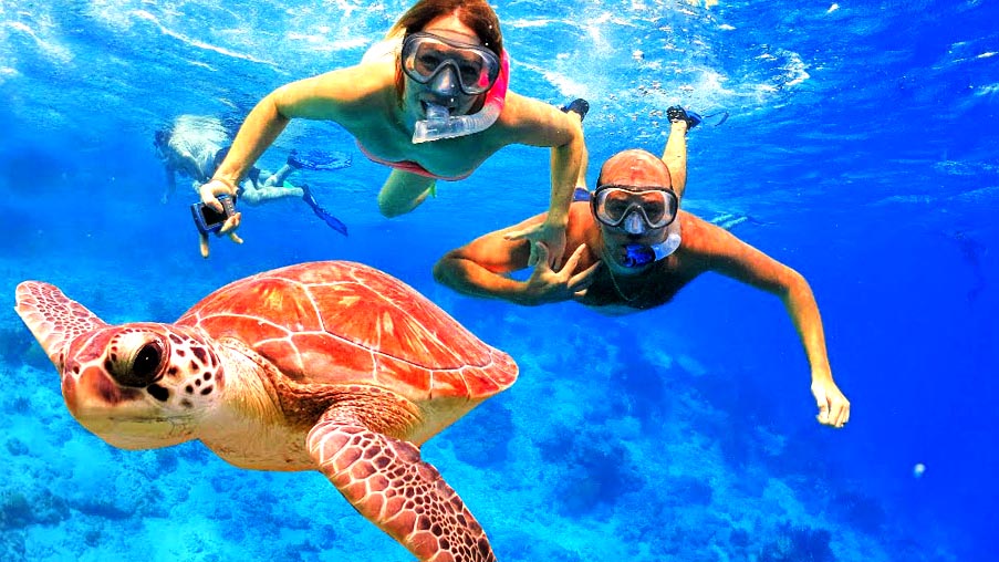
The Coral Garden in Hikkaduwa is considered to be the best out of all such coral gardens found in Asia. There is a reef of
Surfing in Hikkaduwa
Hikkaduwa is best surfing spots in Sri
Kandy
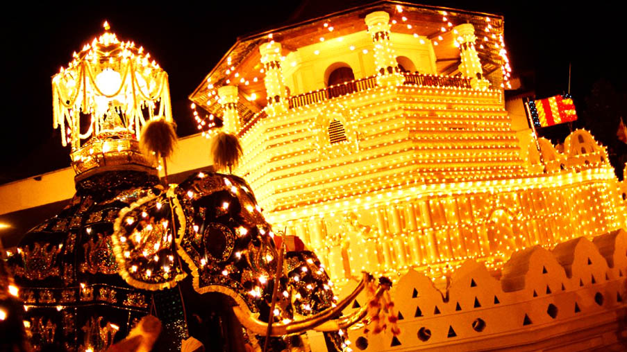
Kandy is a major city in Sri Lanka, located in the Central Province, Sri Lanka. It is the second largest city in the country after Colombo. It was the last capital of the ancient kings’ era of Sri Lanka. The city lies in the midst of hills in the Kandy plateau, which crosses an area of tropical plantations, mainly tea. Kandy is both an administrative and religious city and is also the capital of the Central Province. Kandy is the home of The Temple of the Tooth Relic (Sri Dalada Maligawa), one of the most sacred places of worship in the Buddhist world. It was declared a world heritage site by UNESCO in 1988.
Kataragama
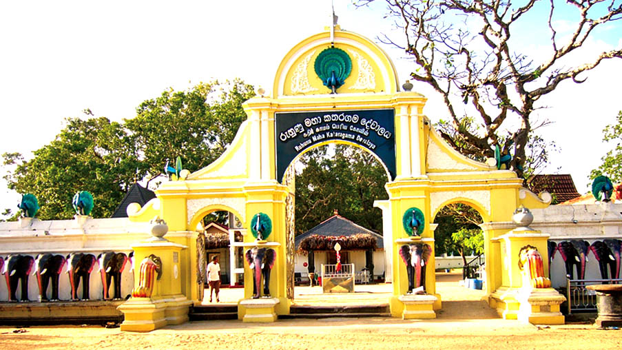
Kataragama is a pilgrimage town sacred to Buddhist, Hindu, Muslim and indigenous Vedda people of Sri Lanka. People from South India also come there to worship. The town has the Ruhunu Maha Kataragama
Yala National Park
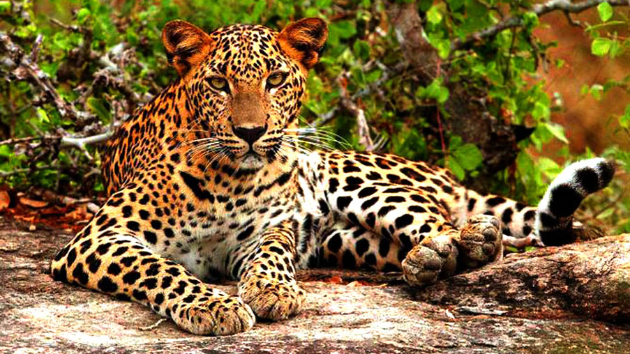
Yala National Park is the most visited and second largest national park in Sri Lanka. The park consists of five blocks, two of which are now open to the public, and also adjoining parks. The blocks have individual names such
There are six national parks and three wildlife sanctuaries in the vicinity of Yala. Among the largest is Lunugamvehera National Park. The park is situated in the dry semi-arid climatic region and rain is received mainly during the northeast monsoon. Yala hosts a variety of ecosystems ranging from moist monsoon forests to freshwater and marine wetlands. It is one of the 70 Important Bird Areas (IBAs) in Sri Lanka. Yala harbours 215 bird species including six endemic species of Sri Lanka. The number of mammals that
The area around Yala has hosted several ancient civilisations. Two important pilgrim sites, Sithulpahuwa and Magul Vihara, are situated within the park. The 2004 Indian Ocean tsunami caused severe
Matale
Matale is the largest city and administrative capital of the Matale District of the Central Province, of Sri Lanka. It is 142 kilometres (88 mi) from Colombo and 26 kilometres (16 mi) from Kandy. Surrounding the town are the Knuckles Mountain Range, the foothills were called Wiltshire by the British. It is a mainly agricultural area, where tea, rubber, vegetable and spice cultivation dominate.

Mirissa

Sleepy Mirissa, 4km southeast of Weligama on the Matara road, has a headland dividing its small fishing harbour from a beautiful curve of sandy beach with calm, clear waters. It’s a low-key, peaceful spot that was once the preserve of backpackers but is now becoming more popular as travellers seek out quieter alternatives to Unawatuna and Hikkaduwa.
Whale watching in Mirissa
Whale Watching Mirissa has been most popular attraction among the tourists who visit
Nillaveli
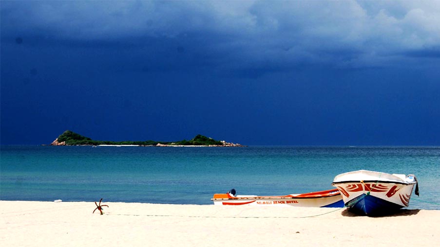
Nilaveli is a coastal resort town located about 20 km North-West of Trincomalee, Trincomalee District, Sri Lanka. During the Summer Season from May – September, the East Coast Beaches of Sri Lanka can justifiably lay claim to being some of the best in the entire world.
Nilaveli is the closest that Sri Lanka gets to the Maldives. The beach is composed of fine, powdery white coral sand where you can wade out to sea at waist height for hundreds of feet in places! The long stretch of beach starts from the hamlet of Uppuveli, just to the north of Trincomalee and continues through Nilaveli to Kuchchaveli after which the jungles of the north of the island take over.
Looking out across the ocean from Nilaveli beach, on the
Nuwara Eliya
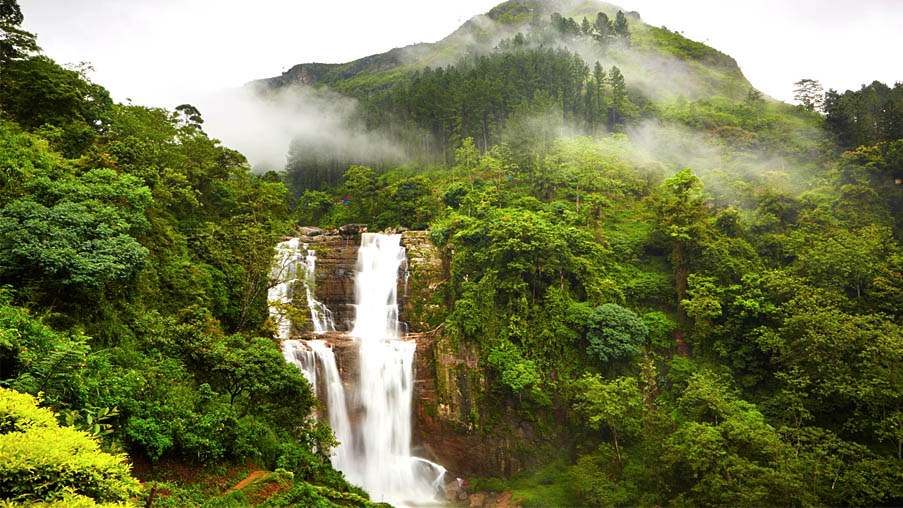
Nuwara Eliya is a city, in the hill country of the Central Province, Sri Lanka. The city name meaning is “city on the plain (table land)” or “city of light”. The city is the administrative capital of Nuwara Eliya District, with a picturesque landscape and temperate climate. It is located at an altitude of 1,868 m (6,128 ft) and is considered to be the most important location for Tea production in Sri Lanka. The city is overlooked by Pidurutalagala, the tallest mountain in Sri Lanka.
The city was founded by Samuel Baker, the discoverer of Lake Albert and the explorer of the Nile in 1846. Nuwara Eliya’s climate lent itself to becoming the prime sanctuary of the British civil servants and planters in Ceylon. Nuwara Eliya, called Little England then, was also a hill country retreat where the British colonialists could immerse in their pastimes such as fox hunting, deer
Although the town was founded in the 19th century by the British, the whole district is today visited by native
Many of the buildings retain features from the colonial period such as the Queen’s Cottage, General’s House, Grand Hotel, Hill Club, Town Post Office and even new hotels are often built and furnished in the colonial style. Anyone who visits the city can wallow in its nostalgia of bygone days by visiting these landmark buildings. Many private homes still maintain their old English-style lawns and gardens.
Polonnaruwa
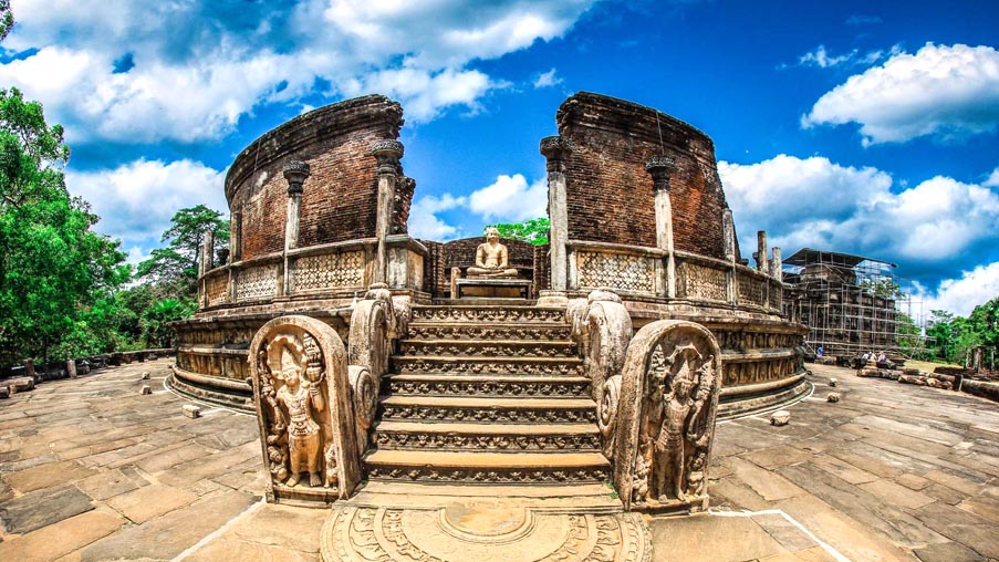
Polonnaruwa is a town. It’s the main town of Polonnaruwa District in the North Central Province, Sri Lanka. Kaduruwela area is the Polonnaruwa New Town and the other part of
The second most ancient of Sri Lanka’s kingdoms, Polonnaruwa was first declared the capital city by King Vijayabahu I, who defeated the Chola invaders in 1070 to reunite the country once more under a local leader.
The Ancient City of Polonnaruwa has been declared a World Heritage Site.
History
While Vijayabahu’s victory and shifting of kingdoms to the more strategic Polonnaruwa is considered significant, the real “Hero of Polonnaruwa” of the history books is actually Parakramabahu I. It was his reign that is considered the Golden Age of Polonnaruwa, when trade and agriculture flourished under the patronage of the king, who was so adamant that no drop of water falling from the heavens was to be wasted, and each was to be used toward the development of the land; hence, irrigation systems that are far superior to those of the Anuradhapura Age were constructed during Parakramabahu’s reign, systems which to this day supply the water necessary for paddy cultivation during the scorching dry season in the east of the country. The greatest of these
With the exception of his immediate successor, Nissankamalla I, all other monarchs of Polonnaruwa were slightly weak-willed and rather prone to picking fights within their own court. They also went on to form more intimate matrimonial alliances with stronger South Indian kingdoms, until these matrimonial links superseded the local royal lineage and gave rise to the Kalinga invasion by King Kalinga Magha in 1214 and the eventual passing of power into the hands of a Pandyan King following the Arya Chakrawarthi invasion of Sri Lanka in 1284. The capital was then moved to Dambadeniya.
Sigiriya (Lion Rock)
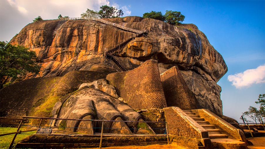
Sigiriya is an ancient palace located in the central Matale District near the town of Dambulla in the Central Province, Sri Lanka. The name refers to a site of historical and archaeological significance that is dominated by a massive column of rock nearly 200 metres (660 ft) high. According to the ancient Sri Lankan chronicle the Culavangsha, this site was selected by King Kasyapa (477 – 495 CE) for his new capital. He built his palace on the top of this rock and decorated its sides with colourful frescoes. On a small plateau about halfway up the side of this
Sigiriya today is a UNESCO listed World Heritage Site. It is one of the
Trincomalee
Trincomalee, one of the finest natural deep-water